Types of photogrammetry: aerial, close-range, satellite and more
The kinds of photogrammetry and what each is for: aerial from drones and aircraft, close-range on the ground, satellite, underwater, stereo pairs and structure from motion, metric and interpretative.
Published · 8 min read · By Malya, the makers of Clarity
One idea, several practices. Photogrammetry is sorted two ways: by where the camera stands, which decides the equipment, the scale and how the model is tied to the world; and by how the pictures are turned into measurements, which has changed completely in twenty years. The first sorting is the useful one for choosing a method; the second explains the words you will meet.
By where the camera is
- AerialFrom a drone, an aircraft or a balloon, looking down. Maps ground: sites, quarries, farms, corridors, towns. Scale from GNSS and ground control.centimetres · hectares to counties
- Close-range and terrestrialFrom the ground, a few metres to a few tens of metres away. Objects, machinery, building faces, accident scenes, rock faces. Scale from scale bars or targets.sub-millimetre to centimetres · objects to buildings
- SatelliteStereo images from orbit, hundreds of kilometres up. Terrain models and orthoimages of regions, at a few metres.metres · regions and countries
- UnderwaterCameras on divers or vehicles, with lights. Wrecks, reefs, pipelines and hulls. Scale from bars; refraction through water complicates the lens model.millimetres to centimetres · metres to tens of metres
Aerial photogrammetry
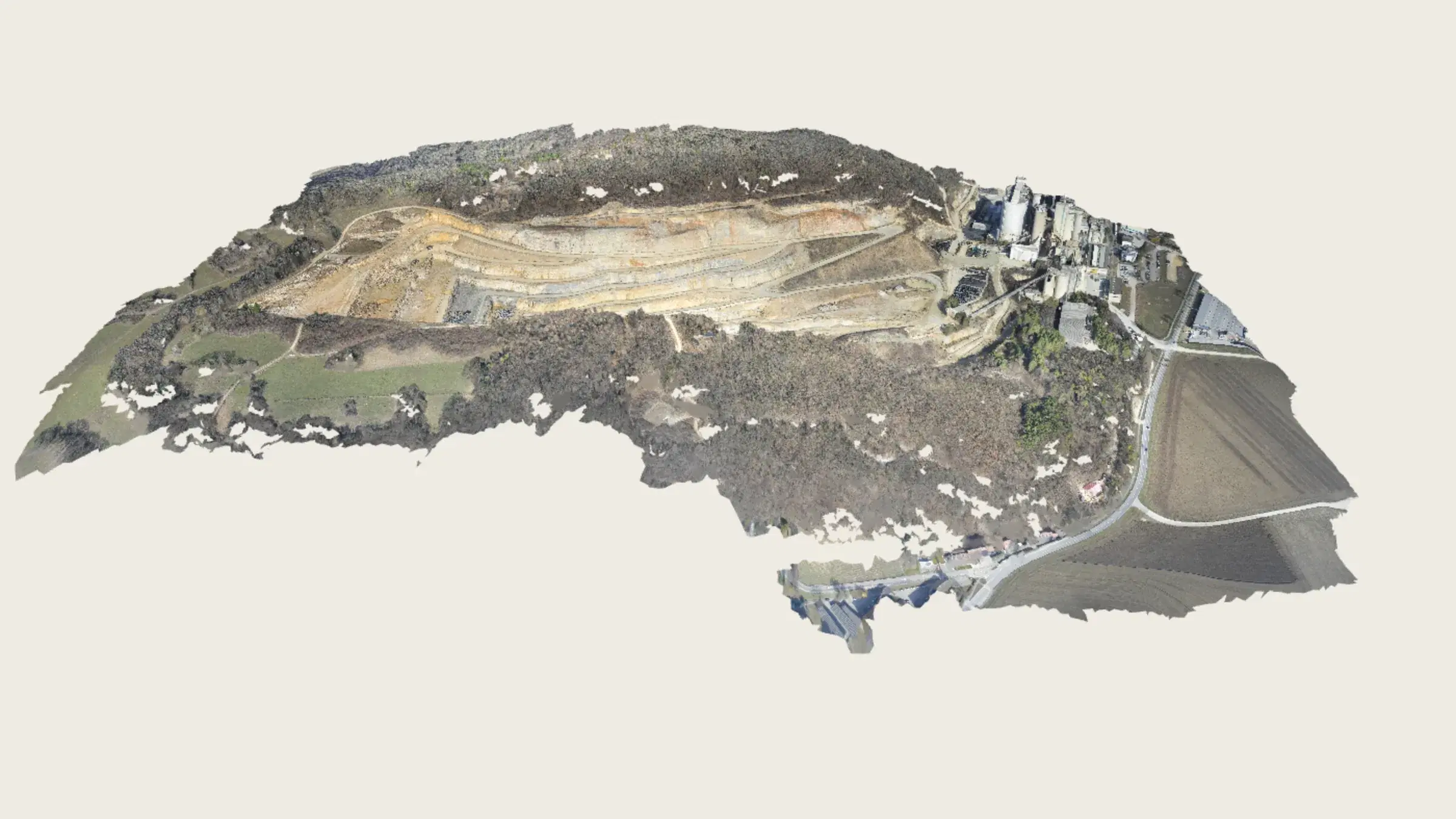
The kind most people mean. A camera flies parallel lines over the ground, taking overlapping photographs straight down (nadir) and sometimes tilted (oblique), and the processing produces the point cloud, orthomosaic and elevation models described in what is photogrammetry. It divides again by the aircraft. The aerial photogrammetry guide follows a drone survey from the flight to the measured map.
| Drone | Crewed aircraft | |
|---|---|---|
| Height above ground | 30–300 m | 500–4,000 m |
| Pixel on the ground | 1–5 cm | 5–30 cm |
| Area in a day | Tens to a few hundred hectares | Hundreds of square kilometres |
| Camera | 20–60 MP, often with RTK positioning | 100–400 MP survey camera with IMU and GNSS |
| Who flies it | The site's own crew, under drone rules | A survey company, under aviation rules |
| Used for | Sites, quarries, farms, short corridors, repeat surveys | Towns, counties, long corridors, national mapping |
Close-range and terrestrial photogrammetry
The camera is on the ground, or in a hand, within a few metres or tens of metres of the subject. The subject might be a casting, a sculpture, a bridge bearing, a façade, a rock face, a crashed car or a crime scene. Scale cannot come from satellites indoors or against a wall, so it comes from scale bars of known length, from coded targets at measured spacing, or from a total station. Accuracy follows the pixel size as it does from the air, and at a metre from the subject the pixel is a fraction of a millimetre, so close-range work can reach a tenth of a millimetre with care.
The failures are the same as from the air and show up sooner: a shiny or dark surface has no texture to match, a moving subject cannot be matched at all, and uneven light makes the same surface look different from different sides. For objects with those surfaces, a structured-light or laser scanner is usually the better instrument.
Satellite photogrammetry
A satellite that can tilt its camera takes two or more images of the same ground from different points along its orbit, and the parallax between them yields a terrain model at a few metres’ resolution. National and global elevation datasets are made this way. It is the only photogrammetry that covers a country, and the only one that cannot reach the centimetre.
Underwater and other places
Cameras on divers, remotely operated vehicles and towed sleds model wrecks, reefs, pipelines and ship hulls. Light does not travel far underwater, so the camera is close and carries its own lights; refraction at the lens port changes the camera geometry and has to be calibrated for. The same techniques map caves, tunnels and the insides of tanks: anywhere a camera can be carried and lit.
By how it is done
Stereo photogrammetry
- Pairs of photographs taken from known positions a known distance apart, the classic aerial survey arrangement.
- Depth from parallax, measured by an operator on a stereo plotter or by software on a pair.
- Still the right description of what the maths does; no longer how most work is organised.
Structure from motion
- Any set of overlapping photographs, in any order, with no camera positions known in advance.
- Features found and matched automatically; cameras and points solved together in a bundle adjustment.
- What drone and close-range software does today. The result is stereo measurement, done tens of thousands of times.
One more pair of words: metric photogrammetry measures, and is what this whole section is about; interpretative photogrammetry reads what is in the pictures (land use, crop condition, damage) and belongs to remote sensing. They use the same imagery and are often done by the same people.
Which one for which job
| The job | The kind | Why | |
|---|---|---|---|
| Stockpile volumes, cut and fill, progress on a site | Aerial, from a drone | Hectares at centimetre accuracy, repeatable monthly by the site's own crew | |
| A façade, a rock face, a bridge bearing | Close-range, from the ground | The surface faces sideways; a drone sees it obliquely at best | |
| A casting, a part, a sculpture | Close-range, on a table | Sub-millimetre needs the camera within a metre and a scale bar in frame | |
| A county, a long pipeline corridor | Aerial, from crewed aircraft | Hundreds of square kilometres in a day; drone rules stop at the horizon | |
| A regional terrain model | Satellite stereo | Only satellites cover that much; metres are enough | |
| A wreck, a reef, a hull | Underwater | The only way to photograph it at all |
Sources
Questions people ask
What are the two main types of photogrammetry?
By where the camera is: aerial photogrammetry, from drones, aircraft or satellites looking down at the ground; and terrestrial or close-range photogrammetry, from the ground looking at objects, faces and structures. The maths is the same; the equipment, scale and control are different.
What is the difference between stereo photogrammetry and structure from motion?
Stereo works from carefully arranged pairs of photographs with known camera positions, the classic aerial method. Structure from motion works from any set of overlapping photographs and solves the camera positions itself. Modern drone software is structure from motion; the result is still stereo measurement, done tens of thousands of times.
What is interpretative photogrammetry?
Reading what is in a photograph rather than measuring it: identifying land use, crop condition or damage from imagery. Metric photogrammetry is the measuring kind. Most survey work is metric; most remote-sensing analysis is interpretative, and the two share the same pictures.
Is satellite imagery photogrammetry?
Stereo satellite imagery is: two or more images of the same ground from different points in the orbit give parallax, and terrain models at a few metres' resolution are made from them. A single satellite image corrected to a map is orthorectification, which uses an existing terrain model rather than making one.
See it on a real site.
Explore is free, with no card and no expiry: a real quarry, already flown and processed, with every measuring tool on it.
Read next
- Photogrammetry glossary: the terms, in plain wordsGSD to tie point: the vocabulary of photogrammetry, each term in a sentence or two.
- What is photogrammetry? Definition, history and usesThe science of measuring from pictures: the idea, the history, and what a survey comes back as.
- How photogrammetry works: structure from motion, step by stepFeatures, matches, bundle adjustment, dense cloud, mesh, orthomosaic: each step, with what can go wrong at it.
- All resources