What is photogrammetry used for? Industries and applications
The industries that use photogrammetry and what they measure with it: construction, mining and quarries, surveying, agriculture, forestry, archaeology, film and games, forensics, insurance, inspection and more.
Published · 10 min read · By Malya, the makers of Clarity
Photogrammetry is used wherever something has to be measured and cannot conveniently be touched: a quarry face, a crop, a crash scene, a cathedral ceiling, an actor’s face. The method is the same in every case, photographs with overlap turned into a measured model; what changes is the scale, the accuracy needed and what is done with the model afterwards. This page goes industry by industry, saying what each measures with it and why a camera won the job.
The industries, at a glance
- Surveying and mappingTopographic surveys, contours, orthomosaics, elevation models and base maps, from a field to a county. The industry photogrammetry was invented for.centimetres · drones and aircraft
- ConstructionPre-design survey, earthworks volumes, progress against the programme, as-built records, and the photographs and issues that go with each. A flight a month.centimetres · drones
- Mining and quarriesStockpile volumes, pit and face surveys, haul road grades, blast reconciliation, tailings monitoring. Where surveyors cannot safely walk.1–3% on volumes · drones
- AgricultureCrop height and vigour, plant counts, drainage and field levelling, variable-rate maps from multispectral cameras flown with the ordinary one.decimetres · drones
- ForestryCanopy height models, stand volumes, tree counts, storm and fire damage, with LiDAR beside it for the ground under the trees.decimetres · drones and aircraft
- Archaeology and heritageExcavations recorded layer by layer, buildings and monuments modelled to the millimetre, inscriptions read from raking light. The record that survives the dig.millimetres · cameras, drones
- Forensics and accidentsCrash and crime scenes reconstructed as measured models before the road reopens: distances, sight lines, skid marks, bullet paths, shown in court.centimetres · cameras, drones
- InspectionBridges, towers, roofs, façades, tanks and solar farms photographed close and modelled, so a crack can be measured and found again next year.millimetres to centimetres · drones
- Insurance and real estateRoof measurements for a quote or a claim, storm damage assessed from the air, properties modelled for listings and for the record before and after.centimetres · drones, phones
- Film, games and museumsActors, props, sets and artefacts captured as textured 3D models: digital doubles, game assets, virtual museums, products for the web.sub-millimetre · camera rigs
- Geology and the environmentLandslides, cliffs, glaciers, dunes and riverbanks measured between dates to see what moved and by how much. Erosion as a number.centimetres · drones
- Underwater and the coastReefs, wrecks and pipelines modelled from diver or ROV photographs; beaches and dunes from the air; shallow beds from the surface where the water is clear.centimetres · underwater cameras
Surveying, construction, mining
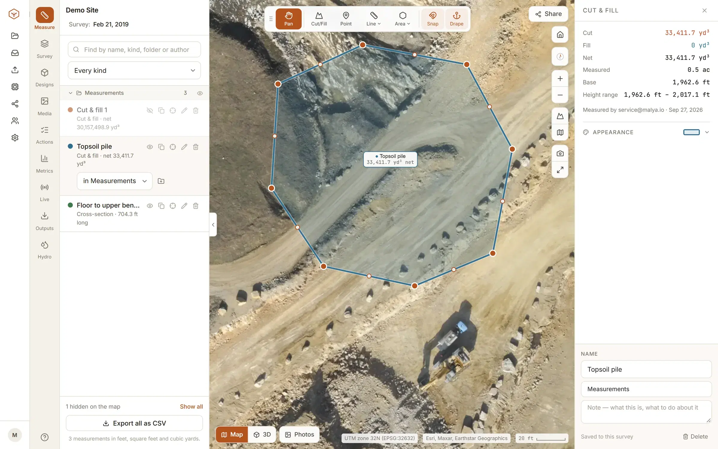
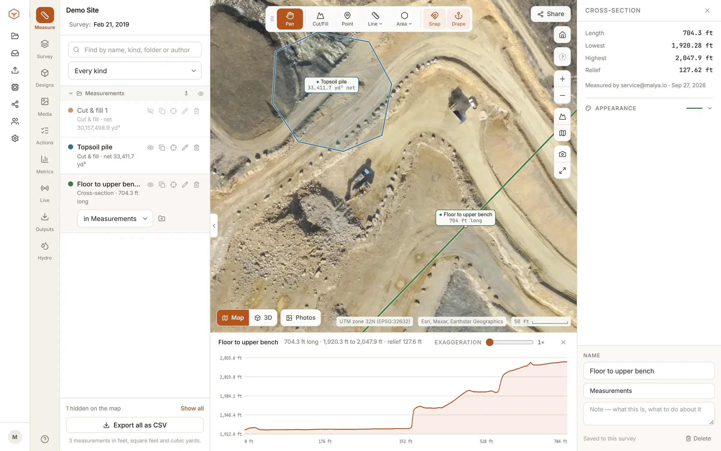
These three measure ground, and ground is what photogrammetry does best: open, textured, still, and seen from above. A surveyor’s drone replaces a day of walking with a half-hour flight and brings back not a few hundred points but a point for every pixel. The construction site flies monthly and reads earthworks volumes, grades and progress off the model; the quarry flies the same way and reads stockpile volumes to a few percent, which is the single most common thing anybody does with a drone survey.
- Surveying
- Topographic survey to a stated accuracy class, contours, the orthomosaic as the base map, cross-sections along an alignment. Control and check points on every job.
- Construction
- Volumes of cut and fill against the design surface, progress by area and element, as-built records at handover, photographs and issues pinned to the map. A flight a month, more during earthworks.
- Mining and quarries
- Stockpile volumes, pit surveys for reserves and reconciliation, face profiles, haul road grades, tailings dam monitoring. Flown where nobody should walk.
Clarity is built for these three: the progress page shows the monthly rhythm, and the stockpile guide the measurement. Where the ground is wooded, the LiDAR comparison says when to fly a laser instead.
Agriculture, forestry, environment
Over fields and forests the questions change from “where is the ground” to “how is the crop”, and the camera changes with them. A multispectral camera, flown beside the ordinary one, records the bands that plant stress shows in before the eye sees it; the photogrammetry on the ordinary camera gives the map those bands are laid on, plus crop height from the surface model, plant counts from the orthomosaic and drainage from the terrain. In forestry the surface model is the canopy, its height above the ground is the stand, and LiDAR supplies the ground the camera cannot see.
Farms
- Plant counts and emergence from the orthomosaic
- Crop height and biomass from the surface model
- Vigour and stress maps from multispectral bands
- Field levelling and drainage design from the terrain
Forests and reserves
- Canopy height models and stand volumes
- Tree counts and species by crown
- Storm, fire and disease damage, dated and measured
- Habitat mapping, dune and wetland change between seasons
Archaeology, heritage, forensics
Here the model is the record, and the thing it records is about to change or disappear: an excavation layer that will be dug through tomorrow, a monument that is weathering, a crash scene that the road has to be reopened over. Archaeologists photograph each layer before removing it and keep a measured model of every stage; conservators model a façade to the millimetre so the next survey can be subtracted from it; investigators photograph a scene from the ground and from a drone and reconstruct it afterwards, measuring distances and sight lines that nobody thought to tape at the time.
- Excavations
- Every context modelled before it is removed; the whole dig reassembled afterwards in one coordinate system. A phone and a scale bar is enough for a trench.
- Buildings and monuments
- Façades, interiors and statuary at millimetre resolution; raking-light photographs that bring out worn inscriptions. Repeated to measure decay.
- Accident and crime scenes
- Models made from photographs taken by officers and by a drone, before the scene is cleared, with scale bars and control. Accepted in court when the capture and its accuracy are documented.
- Museums
- Artefacts modelled for study, replication and display; whole collections captured on turntables and published online.
Inspection, insurance, real estate
An asset owner wants to know what state something is in and whether it has changed. A drone flown close to a bridge, a tower, a tank or a roof brings back photographs an inspector can examine without a rope or a platform, and a model those photographs can be measured and located on: a crack’s length and exact position, a panel’s pitch, a roof’s area for a quote to the square metre. Insurers fly after storms and settle claims from the orthomosaic; estate agents model a property; owners keep a dated record of what was there before the works.
| Measured | Product | |
|---|---|---|
| Roofs | Area, pitch, facets, damage | Measurement report and orthomosaic for the quote or the claim |
| Structures | Crack positions and widths, deflection, section loss, corrosion extent | Model with annotated photographs, repeated between inspections |
| Solar and wind | Panel positions, thermal anomalies, blade damage | Thermal and visible orthomosaics, blade models |
| Property | Boundaries, floor areas, elevations, condition before and after works | Orthomosaic, model and dated photographs |
Film, games, museums, products
The industries that want the model for its own sake, and want it to look right rather than to measure right. A rig of a hundred cameras fires at once and captures an actor’s face in a fiftieth of a second; a prop or a costume goes on a turntable; a location is flown and walked and comes back as a set that can be lit from any angle. The method is the same close-range photogrammetry as the archaeologist uses, with the emphasis moved from control to texture: even light, cross-polarised to kill reflections, and as many pixels on the subject as the lenses allow.
Where photogrammetry wins
- Colour and texture come free with the geometry
- A rig captures a moving subject in an instant
- Any size of subject, from a coin to a canyon
- The kit is cameras, which every studio already owns
Where it hands over to a scanner
- Shiny, transparent or featureless objects
- Fine detail below what the pixels resolve
- Parts that have to fit: engineering tolerances
The 3D scanning comparison draws the line between the two.
Geology, hydrology, the sea
Scientists use photogrammetry to measure change: the same cliff, glacier, dune or riverbank flown twice and subtracted, so erosion, retreat and deposition become volumes with dates on them. Meteorologists measured cloud heights from paired photographs long before drones existed, and the technique still finds the base and top of a storm. Under water, divers and remotely operated vehicles photograph reefs, wrecks and pipelines, and the same software builds models from the pictures, within the limits that light and turbidity set.
What each one needs from the survey
The industries differ less in the method than in what they ask of it. The table is the shorthand: the accuracy the job needs, the product it reads, and the thing it most often goes wrong on.
| Needs | Reads | Watch for | |
|---|---|---|---|
| Surveying | A stated accuracy class, with check points | Contours, DTM, orthomosaic, sections | Vegetation hiding the ground; control at the edges |
| Construction | Centimetres, repeatable month to month | Volumes, grades, progress, photographs | Changing site between flights; the same control each time |
| Mining | A few percent on volumes | Stockpile and pit volumes, face profiles | Dust, shadowed faces, the base surface under a pile |
| Agriculture | Decimetres, bands beyond the visible | Vigour maps, counts, heights | Wind moving the crop between photographs; uniform fields with no texture |
| Heritage and forensics | Millimetres, and a documented capture | Models with scale, annotated photographs | Scale bars forgotten; shiny surfaces; the scene changing before capture |
| Inspection | Finding the same spot next year | Located photographs, measured defects | Rolling shutter close to a structure; wind near it |
| Film and products | Pixels on the subject, even light | Textured meshes | Reflections, movement, hair and glass |
Whatever the industry, the first three are the ones Clarity is made for. The stockpile, cut and fill and contours pages go through the jobs, and the equipment page says what to buy for it.
Sources
Questions people ask
What can photogrammetry be used for?
Anything that needs the shape, size or position of something measured from a safe distance: surveying land, measuring stockpiles, tracking construction, mapping crops and forests, recording archaeological sites and buildings, reconstructing accidents and crime scenes, inspecting roofs and structures, and making 3D models for film, games and museums.
Which industries use photogrammetry most?
Surveying and mapping, construction, and mining and quarrying, because they measure ground and volumes every month. Agriculture and forestry use it over large areas; archaeology, heritage and forensics for the record; film, games and e-commerce for the models.
Is photogrammetry used in construction?
Widely: for the topographic survey before design, for earthworks volumes and progress against the programme during the build, for as-built records at handover, and for the site photographs and issues that go with each. A drone flight a month is the usual rhythm.
How is photogrammetry used in mining?
For stockpile volumes (the single most common use), pit and face surveys, haul road grades, blast planning and reconciliation, and tailings and waste dump monitoring. Drones fly where surveyors cannot safely walk, and the volumes come back the same day.
Can photogrammetry be used in forensics?
Yes. Accident and crime scenes are photographed from the ground and the air and reconstructed as measured 3D models, so distances, sight lines and skid marks can be measured after the scene is cleared and shown in court. The method is accepted when the capture is documented and the accuracy stated.
See it on a real site.
Explore is free, with no card and no expiry: a real quarry, already flown and processed, with every measuring tool on it.
Read next
- What is photogrammetry? Definition, history and usesThe science of measuring from pictures: the idea, the history, and what a survey comes back as.
- Photogrammetry equipment: everything you need, from phone to droneThe kit, from a phone and a scale bar to an RTK drone and a scanning robot, and what each buys you.
- Drones for photogrammetry: multirotor, fixed-wing and VTOLMultirotor, fixed-wing or VTOL, with or without RTK: which drone maps which site.
- All resources