Stockpile volumes from a drone survey, with the base shown
Draw the toe of the pile and Clarity adds up what stands above the ground. The base it measured from is printed beside the volume, so whoever signs for the number can see where it came from.
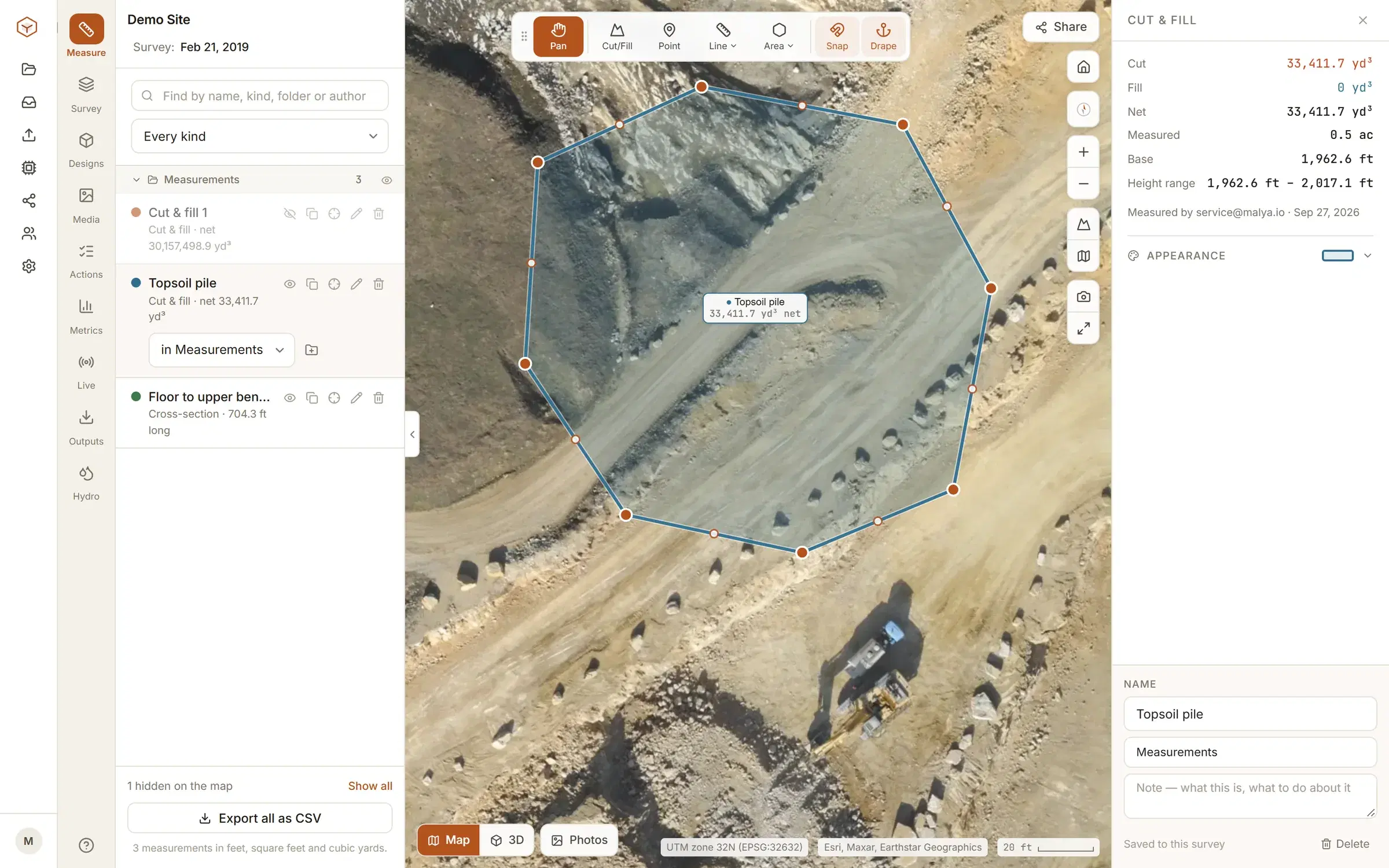
How the volume is worked out.
The volume tool reads the terrain model, not the picture. Inside the boundary you draw, it takes the height between the ground and a base surface and adds that up over the area. Ground standing above the base is reported as cut, ground below it as fill, and the net of the two beside them.
So a stockpile volume rests on two things. One is the terrain model, which is only as good as the flight. The other is the base, which is a choice. Clarity lets you make that choice and then prints it with the answer.
The same tool measures a pit, a pad or a whole earthworks cut. That side of it is on the cut and fill page, and every other measurement is under Tools. For a rough figure before anyone flies, try the stockpile volume calculator.
Pick what the pile is sitting on.
The right base depends on the ground under the pile, not on the pile. The one you chose is shown with the result.
The highest point and the mean height inside are there as well, for a pit, a trench or a void you are pricing to fill.
- Lowest point inside
- Everything above the lowest point inside the boundary counts. Right for a pile on flat ground.
- A best-fit plane
- A tilted plane fitted through the ground along your boundary. The one for a pile on a slope.
- A fixed level
- A level you type in: a pad height or a design level you already know.
- Levels at each corner
- One level per corner of the boundary, interpolated between them. For a pad, a bench or a cell floor.
- Another flight
- An earlier flight of the same site, for what has been added to the pile or drawn down since.
- A design surface
- The LandXML or DXF surface your engineer exported, when the pile has to be measured against a design.
A pile on a slope is where volumes go wrong.
Measure a pile that stands on a slope from one flat level and the wedge of hillside under it is counted as pile. In our own test, a cone on ground falling 1 in 20 came out 68% high from its lowest point.
The best-fit plane is fitted to the ground heights along the boundary you draw. Draw it on the ground just outside the toe and the base lies on the slope the pile stands on. Draw it part-way up the heap and the base tilts into the material, so the pile reads low; the boundary stays on the map, and its corners can be dragged.
Checked against a solid whose volume is known by formula, that plane lands within about a percent. Against a real pile the limit is the flight: its resolution, its overlap and whether you used ground control. A standard mapping flight typically gives about 2 cm per pixel.
- One flat level, at the lowest point
- 3,509 m³
- 68% high
- Plane fitted to the ground round the toe
- 2,094 m³
- within 1%
- Analytic answer for the solid
- 2,094 m³
- known by formula
From cubic metres to tonnes.
The volume is geometry. A figure for the stock report takes three more settings, and they are yours.
Tonnage
Type a density in tonnes per cubic metre and the result carries the mass beside the volume.
Swell and shrink
A factor on the cut and a factor on the fill, for material that bulks when it is dug and tightens when it is placed.
Deadband
Height differences smaller than the figure you set are ignored, so survey noise is not counted as material.
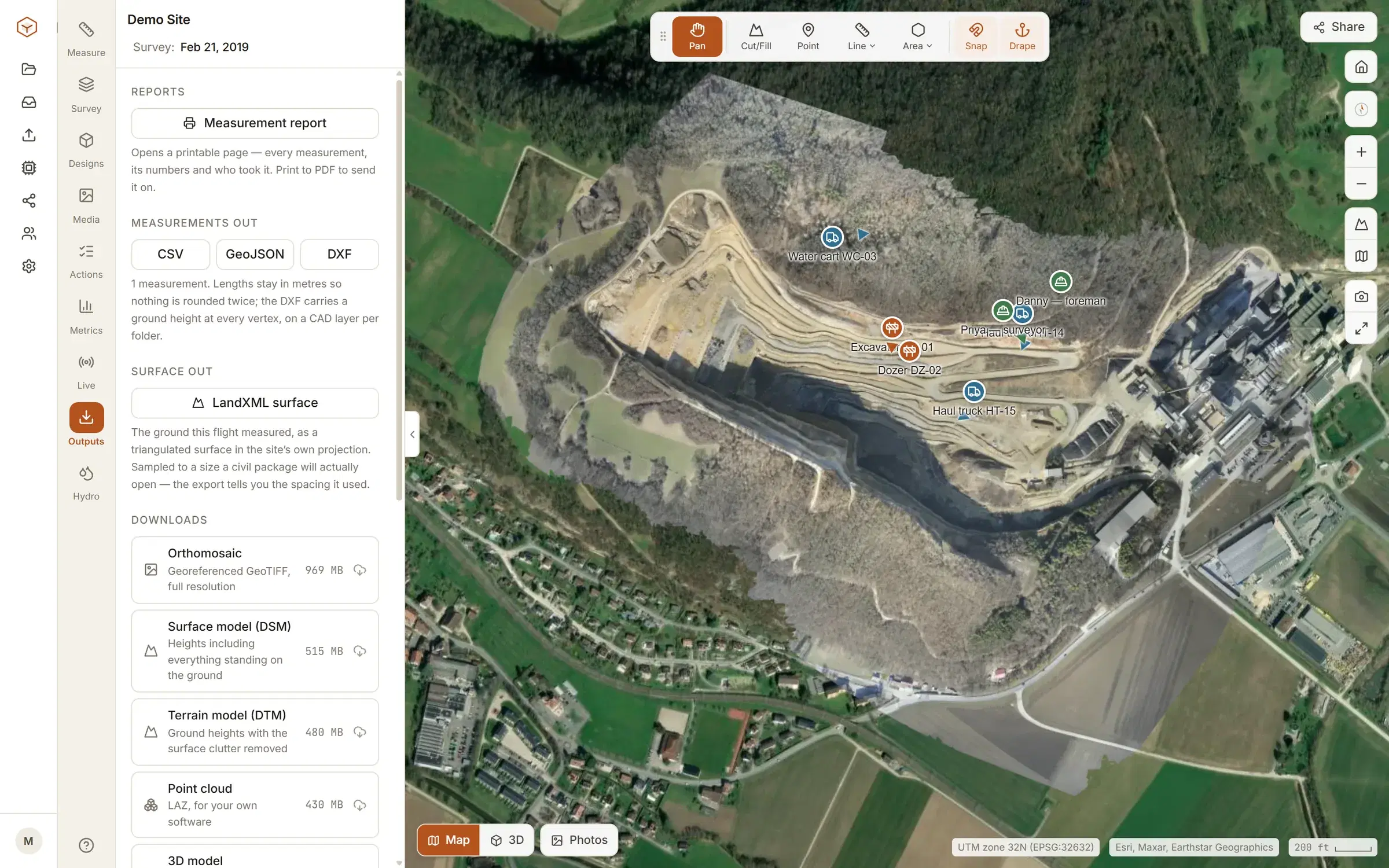
What comes with the number.
A volume on its own is a claim. These are printed with it. They go out in the CSV and GeoJSON; the printable report carries the volumes and the area.
- Volumes
- Cut, fill and net
- Base
- The level or surface used
- Area
- Measured, and drawn
- Heights
- Lowest to highest inside
- Coverage
- Said when the base stops short
- Out
- CSV, GeoJSON, DXF, printable report
The area printed is the part of your boundary that had ground under it. Each measurement is saved to the flight it was taken on. Exports are part of Studio and Enterprise.
Our piles are free. Yours are $50 a month.
On Explore the stockpiles are already there: a sample quarry, flown and loaded in your account, with the volume tool working on real ground. No card, and it does not expire.
To measure your own, Studio is $50 a month for up to five sites, with no charge per person. Bring the orthomosaic and the surface and terrain models your processing software already produces, as GeoTIFFs. Studio does not process raw photos.
If you would rather hand over the photos, or have the site flown for you, that is Enterprise, priced with us directly. What each plan includes, and how a flight gets in.
Fly the yard every month and each flight sits on one timeline, so stock can be measured against the flight before. How flights are compared.
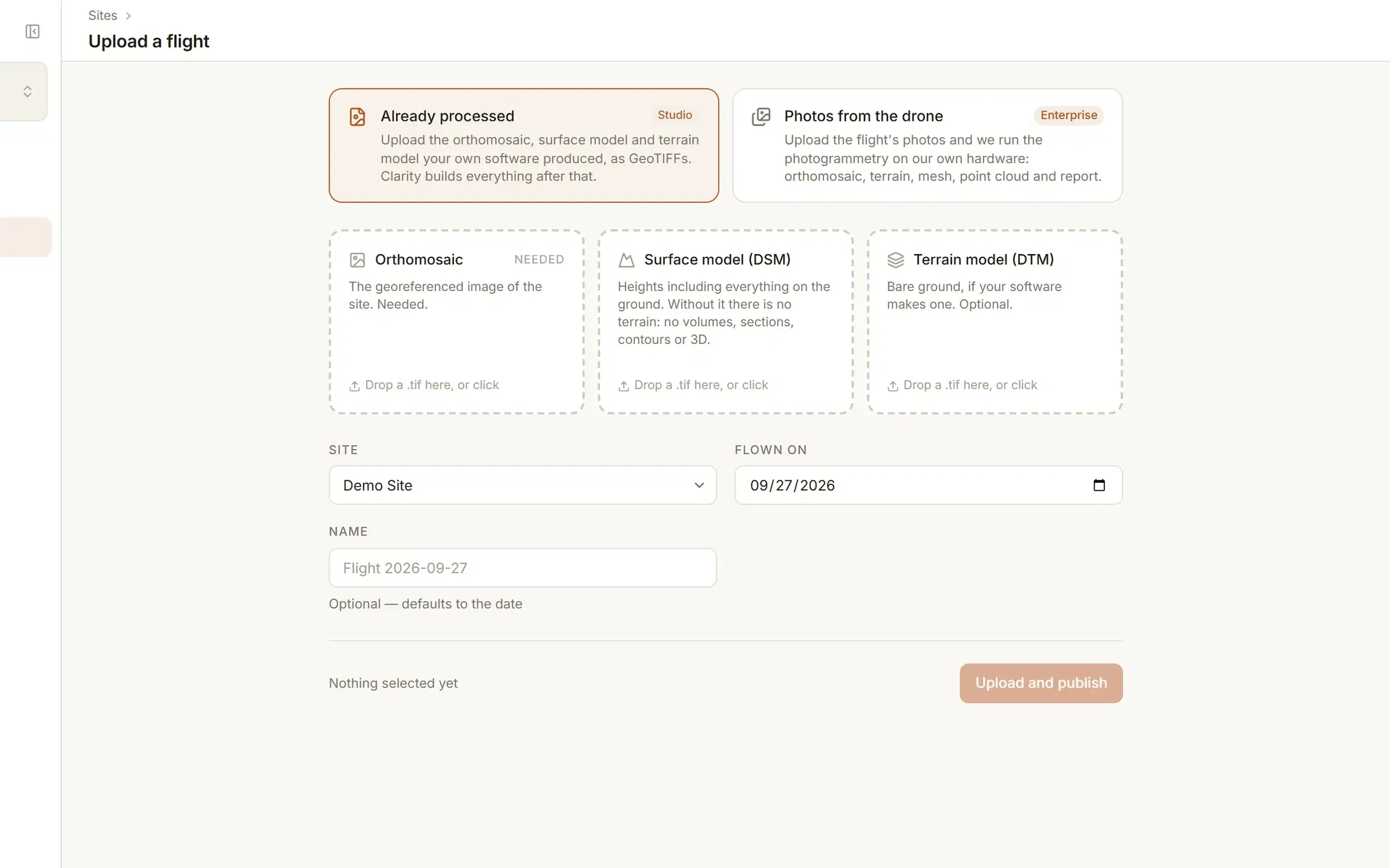
Measure a pile before you fly one.
The demo quarry is in every new account, free. See pricing for your own sites.