How to choose drone survey software.
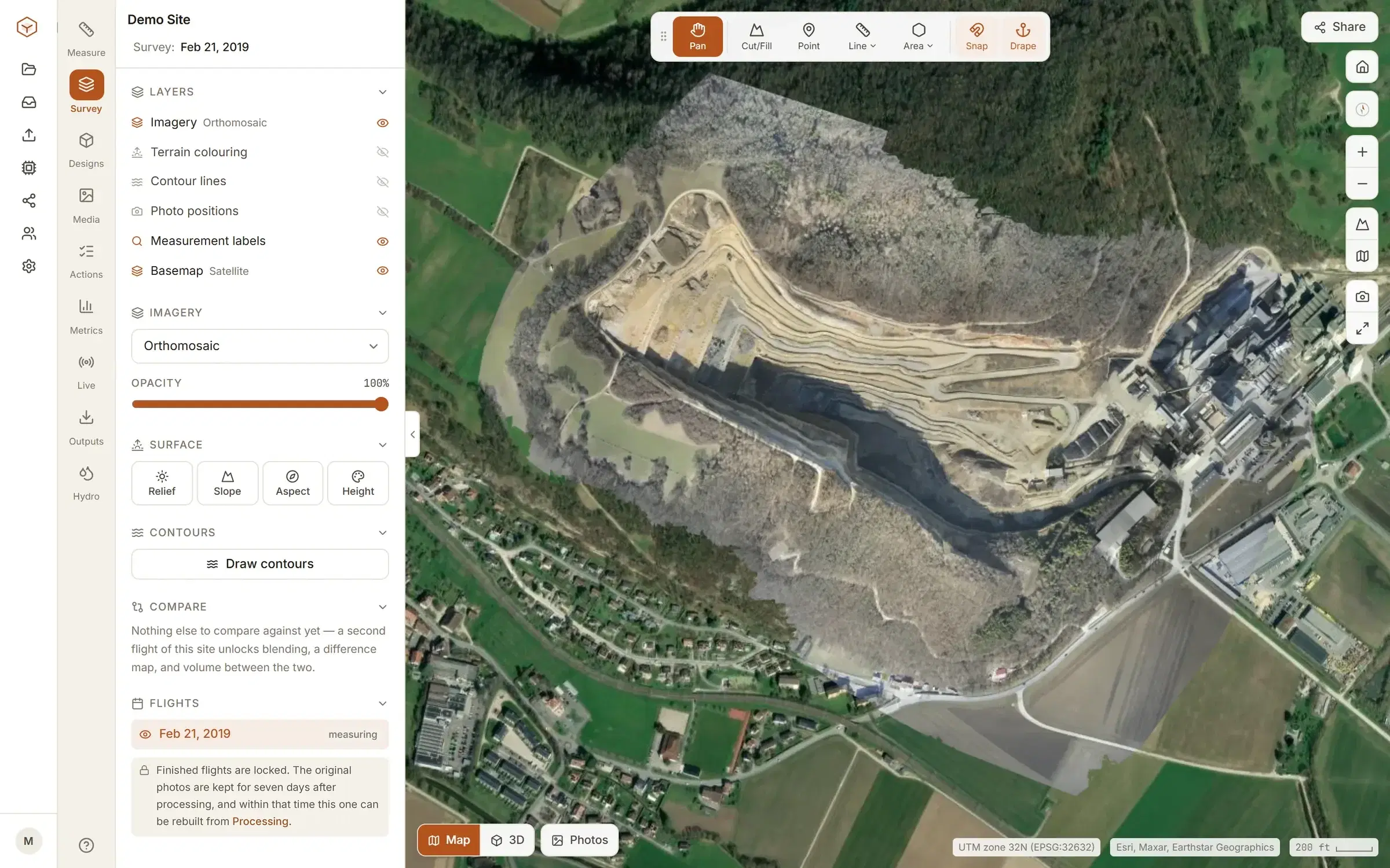
Most platforms can turn a flight into a map. What separates them is what they cost, what they ask of you, and whether you can check the numbers and take them with you. Here are the questions worth asking, and how Clarity answers each.
Six questions worth asking.
Ask them of any platform you are considering. These are Clarity’s answers.
Can you see the price before you talk to anyone?
Explore is free, with no card and no expiry. Studio is $50 a month. Both are on the pricing page. Enterprise, where we process the photos, is priced with us directly.
Do you pay for every person?
Studio is one flat charge for the organisation, however many people are on it: surveyors, viewers, the client.
Does it tie you to particular hardware?
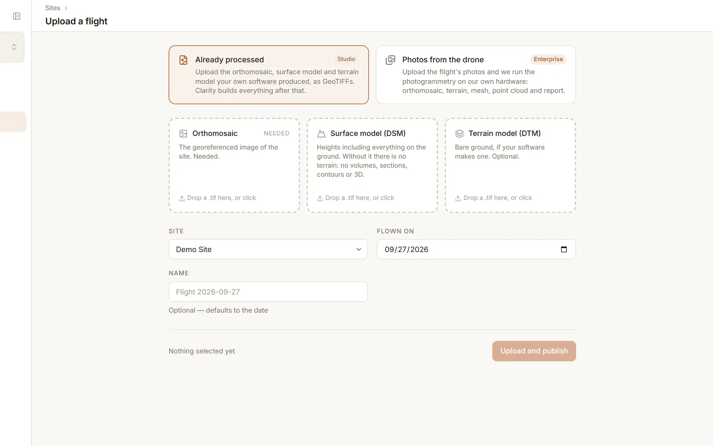
Clarity sells no hardware and asks for none. On Enterprise we process photos from any drone that writes its GPS position into them. On Studio you bring finished GeoTIFFs from the software you already use.
Can you check a volume, not just read it?
Every volume shows the base it was measured from and how much of the area you drew was measured, so a number can be checked before it is sent.
Do two flights line up?
When you compare two flights and they sit at different heights as a whole, Clarity says so beside the result. You can line them up on ground you know did not change, and every figure built that way is marked.
Can you take your data out?
On Studio and Enterprise: measurements as DXF, CSV or GeoJSON, contours as DXF, surfaces as LandXML, and the orthomosaic and terrain model as the files themselves. Your data stays yours, and it is not used to train AI models.
Who Clarity suits.
A crew that flies its own sites, wants the measurements in a browser, and wants to know what it costs before it starts.
Every measuring tool is listed under Tools. Studio adds your own sites, design surfaces, comparing flights, share links and exports.
- Smaller teams
- One flat charge for the organisation on Studio. Up to five sites, with unlimited flights on each.
- Any drone that geotags
- On Enterprise we process the photos. On Studio the drone does not come into it: you bring finished GeoTIFFs.
- Measurements in a browser
- Volumes, cut and fill, cross-sections and contours, with nothing to install.
- Bring your own GeoTIFF
- If your own software already makes the orthomosaic and the surface and terrain models, upload them and measure them here.
Try it on a real site.
The quickest way to judge survey software is to measure something in it.
- 1Create an accountExplore is free. No card, and it does not expire.
- 2Measure the demo quarryA surveyed site is already in your account. Measure a stockpile, drop a cross-section, draw contours, open the 3D mesh.
- 3Bring your own ground when you are readyStudio is $50 a month for up to five sites. Upload your orthomosaic, surface model and terrain model as GeoTIFFs and invite the crew.
The whole path, from upload to export, is on the product page.
Before you choose, the measurements themselves.
How a volume is made, what accuracy to expect, what the files are. Written for the person who has to defend the number.
- How to measure stockpile volume with a droneThe flight, the surface, the base under the pile, and the one choice that changes the number most.
- Construction progress monitoring with drones: tracking and reportingWhat a flight measures that a site walk cannot, how often to fly, and what goes in the monthly report.
- Construction punch lists and field quality observationsWhat each record needs, a workflow from raised to closed, when an observation becomes an NCR, and the numbers worth watching.
- Aerial photogrammetry: how drone photos become survey mapsFrom overlapping photos to a measured map, step by step, and when LiDAR is the better tool.
- Cut and fill calculation: grid, cross-section and surface-to-surfaceThree methods, what each needs, and why a surface-to-surface comparison from a drone survey is the one that covers the whole site.
- Drone survey accuracy: what GCPs, RTK and PPK really give youExpected accuracy in centimetres, with and without ground control, RTK or PPK, and how to prove it on your own site.
- DSM vs DTM vs orthomosaic: what each one is forThe three outputs of a survey, what each contains and which one to measure on.
- Drone surveying for construction: what you get and when to use itWhat a drone survey delivers, where a rover still wins, and hiring it in against flying it yourself.
- What a drone survey costs: per acre, per flight and the processingThe flight, the ground control, the processing and the software, with real ranges.
- Comparing two drone surveys: progress, and why flights don't line upProgress and volume between two flights, and the height offset that catches people out.
- How to fly a drone for photogrammetry: overlap, height and GSDOverlap, height, ground sample distance and the mistakes that cost a reflight, with a calculator.
- Free drone mapping software: what you get without payingWhat a free tier gives you, what processing costs and why, and how to get a lot done for nothing.
- Stockpile inventory for quarries and aggregates by droneMonth-end inventory by drone: the flight, the volumes, tonnage, and numbers an auditor can follow.
- Stockpile volume calculator: cone and windrow piles, with tonnesVolume and tonnes from base and height, for a cone or a windrow.
- Cut and fill calculator: average end area between cross-sectionsCut, fill and net from the areas on your cross-sections, by average end area.
- GSD calculator: ground sample distance, overlap and photo spacingGround sample distance, footprint, spacing and photo count for a mapping flight.
See whether it is enough for your site.
Every measuring tool works on the demo site the moment you sign up. See pricing for your own.