A survey says what is there. A site flown every month says how it is going.
Construction progress monitoring and reporting, from drone surveys you are already flying. Every flight of a site sits on one timeline. Play it, compare two dates, difference them, and put names on what needs doing next.
Four ways to compare.
Nothing to set up. The timeline builds itself from the flights you upload, and measurements stay with the flight they were taken on. It comes with Studio and Enterprise. Heights only compare between flights that share them: fly with ground control or RTK each time. Difference two flights that stand more than about half a metre apart as a whole and Clarity says so beside the result.
- 01
Slide through the dates
A slider under the map runs through every flight of the site. Drag it and each one fades into the next under a camera that never moves; press play and a year of work runs as a short film. Tick the flights you want on it, or set the dates it runs between.
- 02
Lay two dates over each other
Pick two flights and the same slider fades one into the other, so a stockpile that moved is seen moving. Or drag a divider across them, or set them side by side under one camera.
- 03
Difference them
A map of where the ground rose and where it fell, with cut, fill and net across whatever you are looking at.
- 04
Find what changed
The ground that moved, grouped into separate patches with their own volumes, so a month reads as a list of jobs rather than one total.
From what changed to how much.
A map of change is not a quantity. These are the measurements a monthly valuation or an earthworks claim is built on.
The detail is on two pages of its own: cut and fill against a design surface, and stockpile volumes. Every other measurement is under Tools. How the numbers become a monthly progress report is in the progress monitoring guide.
- Against the last flight
- Draw a boundary around a pad, a cell or a stockpile and measure this flight against an earlier one. Ground that is now higher counts as fill; ground that has dropped counts as cut.
- Against the design
- Bring the surface your engineer exported, as LandXML or DXF. Cut is ground still standing above it, and fill is what it would take to bring the ground up to it.
- With the noise left out
- Two surveys of ground nobody touched never agree exactly. Set a deadband and height differences smaller than it are not counted as movement.
- Along a line
- Cross-sections can overlay the site's other flights, so a batter, a drain or a haul road can be read along its length rather than guessed from above.
Photos, notes and the people who fix things.
A site photo lands on the map where it was taken. Write what is wrong, hand it to somebody, and it stays open until they close it.
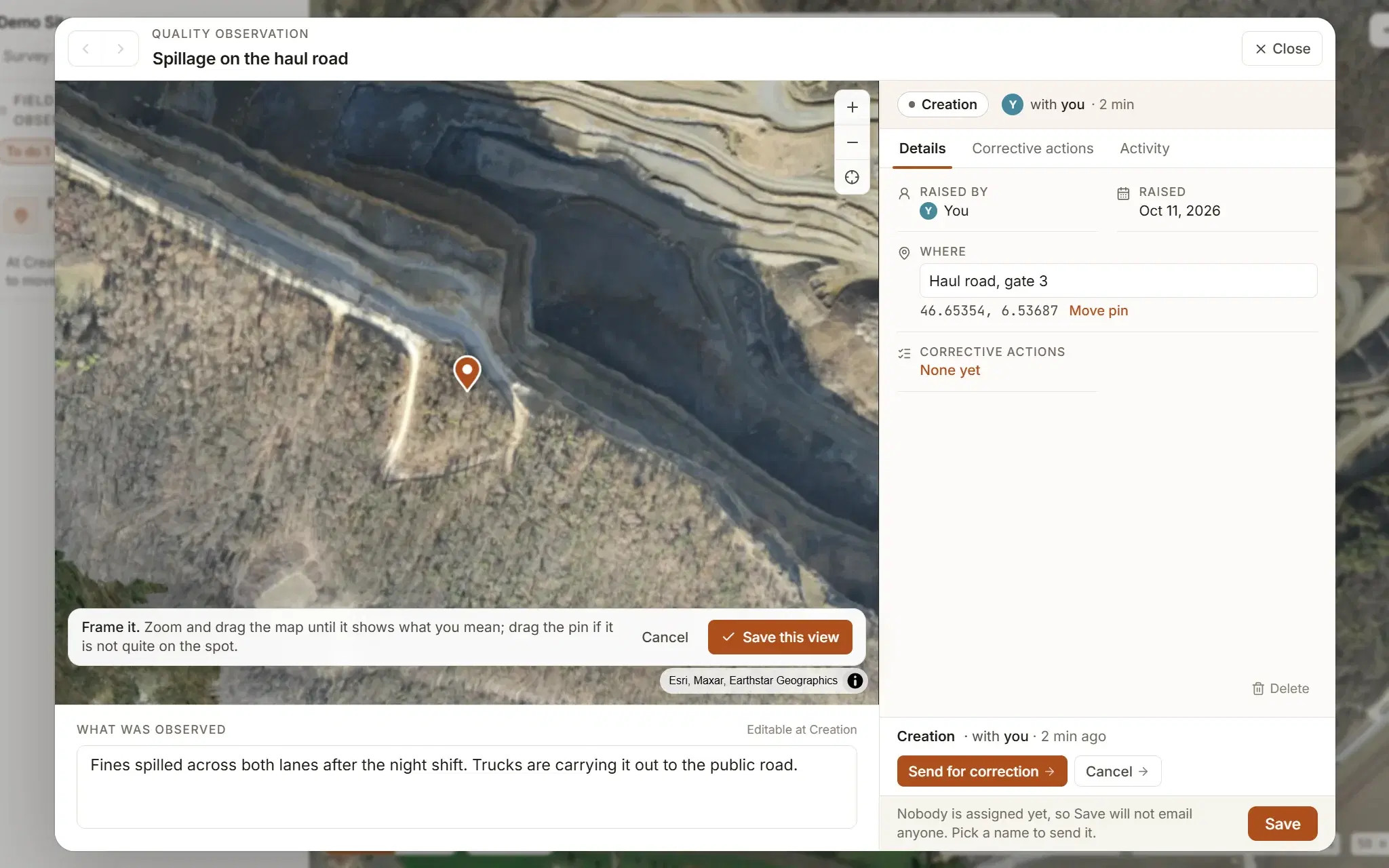
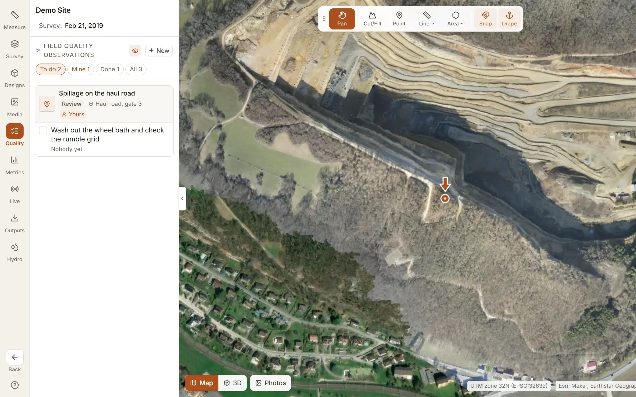
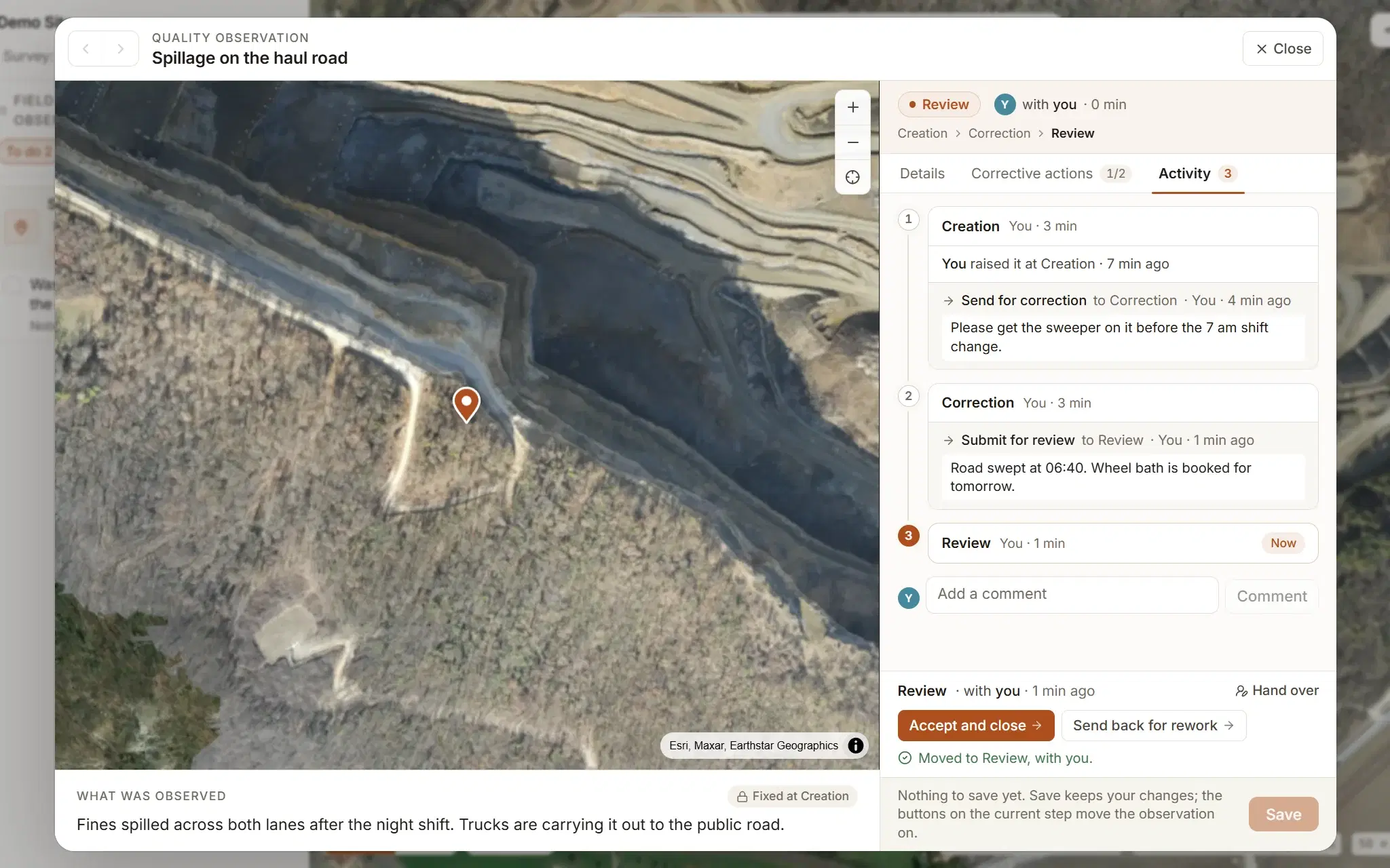
Field quality observations
To do, mine, done. Each one knows its photo, its place, its step and its person, and the person gets an email.
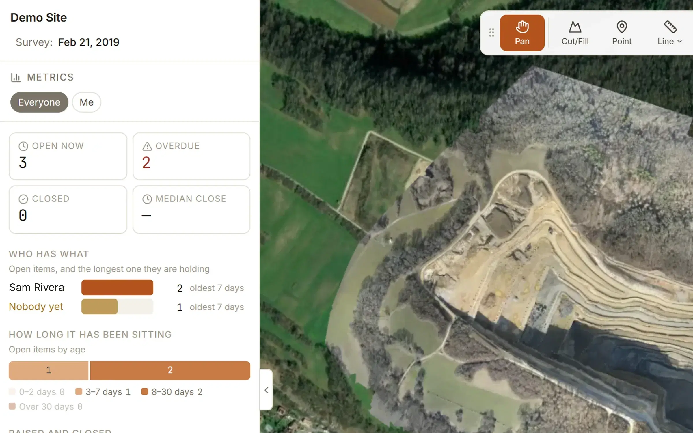
Metrics
How many are open, how long they stay open, who closes them, and the whole list as an Excel workbook from the Outputs tab.
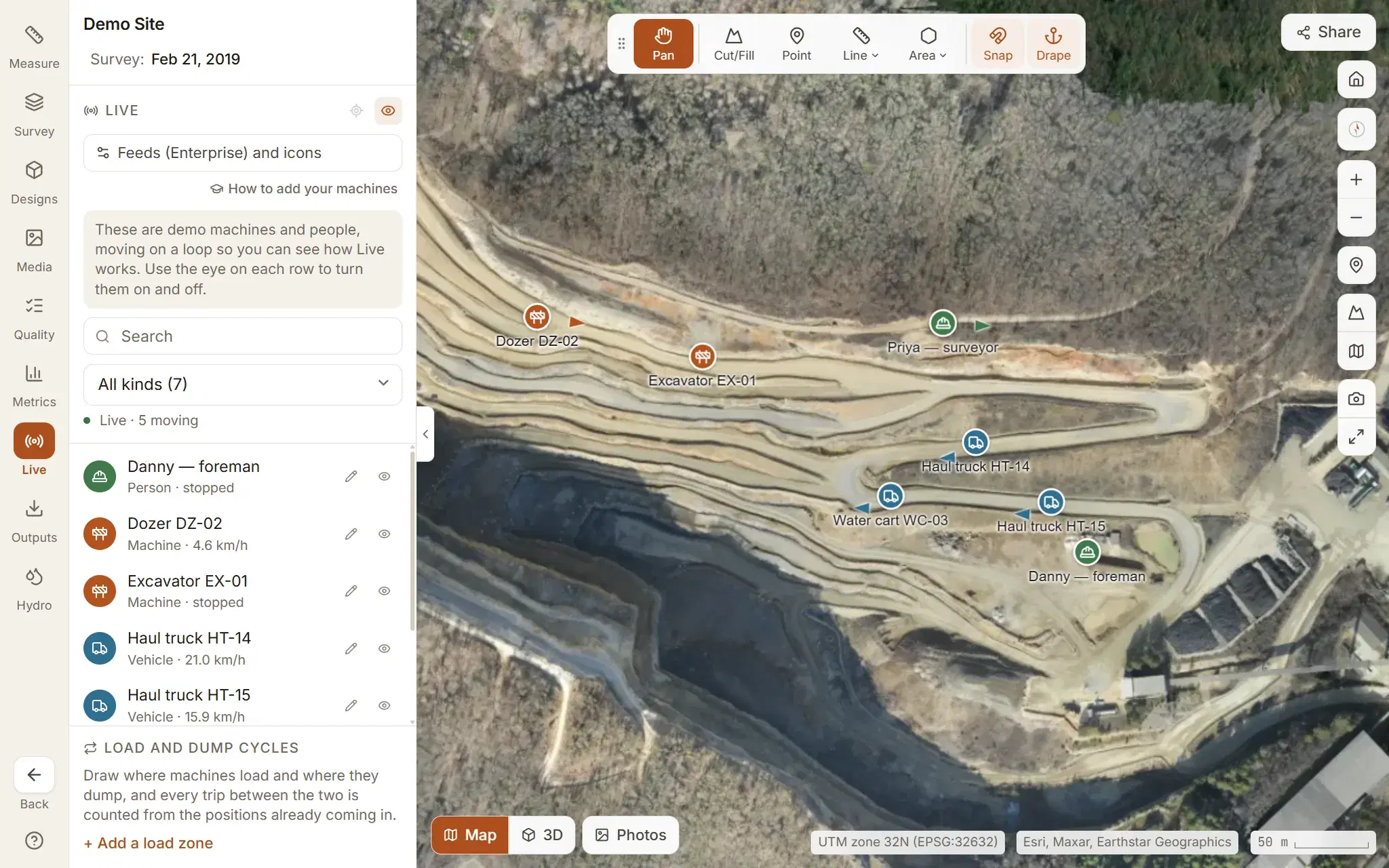
Live machines and people.
A second map, for right now: every tracked truck, dozer, excavator and surveyor on the site, with status, speed and trail.
Clarity reads positions from a database you already have, such as Databricks, SQL Server, Postgres or MySQL, on a schedule, or hands your trackers a key to push to. Both feed the same map. Every plan gets a demo fleet moving on the demo site to see how it works; connecting your own is part of Enterprise.
Fly it again, and the record builds itself.
Progress tracking only lasts if the second flight is no more work than the first.
Upload the new flight to the same site and it takes its place on the timeline. On Studio there is no limit on flights per site, so a site flown weekly costs the same as one flown once a quarter.
What you measured leaves when you need it to: measurements as CSV, GeoJSON or DXF, observations as an Excel workbook, and a printable report you can save as PDF. Everything that can be exported is listed on the product page.
The client and the engineer do not need an account. A share link opens one flight, read-only, and stops opening the moment you revoke it.
All of this starts on Studio, because comparing needs two flights of a site that is yours: $50 a month for up to five sites, with no charge per person. Studio takes the orthomosaic and terrain models you have already processed, as GeoTIFFs. If you would rather hand over the photos, that is Enterprise. What each plan includes.
See it move before you pay for it.
The demo site has a fleet on it and every measuring tool switched on. Comparing flights, designs and exports start on Studio.